
Press releases
OCEAN SIGNAL WINS OVERALL DAME DESIGN AWARD 2022 FOR RESCUEME PLB3 AIS PERSONAL LOCATOR BEACON

Global Search and Rescue Day · 10 September
You activate a 406 MHz emergency beacon. What happens next?
Cospas-Sarsat is the international satellite Search and Rescue system that detects compatible 406 MHz distress beacons and routes their alerts towards rescue authorities around the world.
It is a global safety net used across maritime, aviation and outdoor or wilderness emergencies: EPIRBs carried by vessels, ELTs fitted to aircraft and Personal Locator Beacons carried by people.
From the moment a beacon is activated to the point where an alert reaches a rescue coordinator, satellites, ground stations and Mission Control Centres work together to turn a radio transmission into an actionable Search and Rescue case.
And while that infrastructure is global, one important part remains in your hands: registering your beacon and keeping the record current.
Headline figures in this guide follow the International Cospas-Sarsat Programme’s official 2026 Global Search and Rescue Day verified figures. Detailed 2024 rescue-event, beacon-population and infrastructure data are drawn from System Data No. 51, December 2025.

On 10 September 1982, a small aircraft crashed in British Columbia, Canada. Three people survived and activated an emergency beacon recovered from the wreckage. A satellite detected the transmission and the resulting location information helped rescuers reach them.
It became the first rescue credited to what would become the international Cospas-Sarsat system.
Today, 10 September is recognised as Global Search and Rescue Day, honouring the Search and Rescue professionals, and especially the Mission Control Centre operators, who answer distress alerts around the clock, all year long.
For Global Search and Rescue Day 2026, Cospas-Sarsat’s verified campaign figures state that the system has helped rescue more than 70,000 people over land, sea and air since 1982, across around 22,000 Search and Rescue operations. Global Search and Rescue Day →
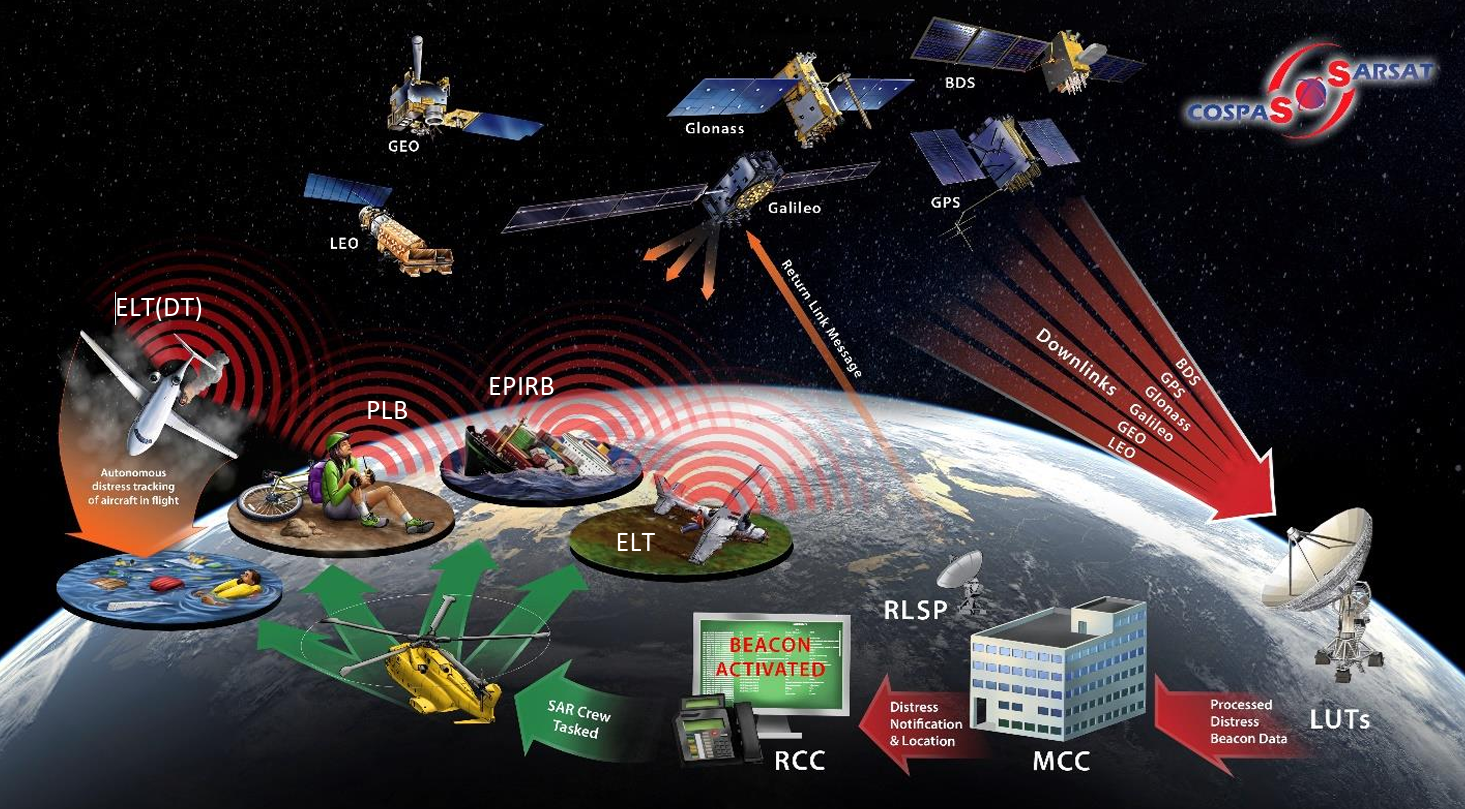
Cospas-Sarsat is an international, intergovernmental satellite-based Search and Rescue system that detects and locates compatible 406 MHz emergency distress beacons and distributes their alerts towards the authorities responsible for coordinating rescue.
It is not a commercial messaging company, a phone network or a service tied to one beacon manufacturer. Approved 406 MHz PLBs, EPIRBs and ELTs from manufacturers around the world are built to communicate through the same international SAR infrastructure.
What does Cospas-Sarsat stand for? SARSAT stands for Search and Rescue Satellite-Aided Tracking. COSPAS comes from the Russian name for the satellite search-and-rescue system developed by the former Soviet Union. The two programmes were brought together to form the international Cospas-Sarsat system.
In simple terms: a 406 MHz beacon is activated; satellites detect the distress transmission; ground stations and Mission Control Centres process and route the alert; and the responsible local Search and Rescue authority coordinates the physical response.
International Cospas-Sarsat Programme →
Think of the system in three connected parts:
One system · three rescue environments
The same 406 MHz Cospas-Sarsat infrastructure supports distress alerting at sea, in the air and across remote terrain. While the type of beacon may change based on specific use case; the international rescue network behind it does not.
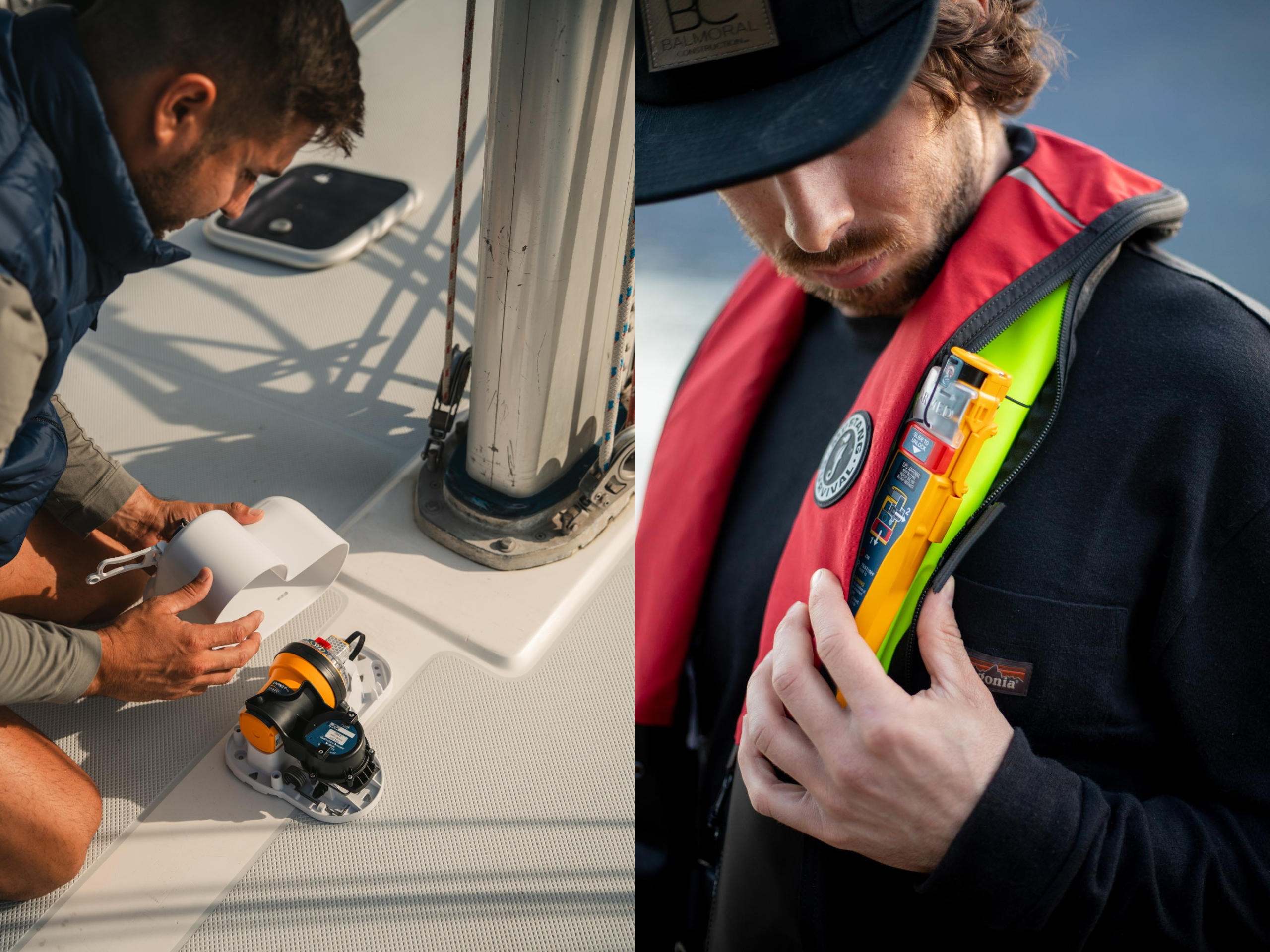
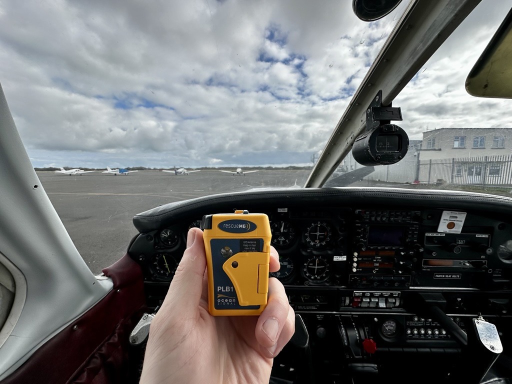
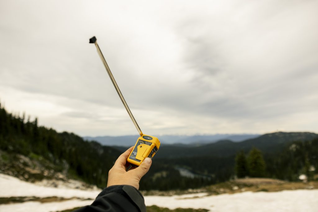
This cross-domain role is visible in the official rescue data. In 2024, Cospas-Sarsat alert data assisted 1,171 confirmed SAR events: 496 maritime, 479 land and 196 aviation. Those incidents involved at least 3,211 people rescued.
By number of 2024 SAR events, the split was 42% maritime, 41% land and 17% aviation. By people rescued, it was 64% maritime, 22% land and 14% aviation.
Source: International Cospas-Sarsat Programme, System Data No. 51, December 2025, pp. 3-4 →
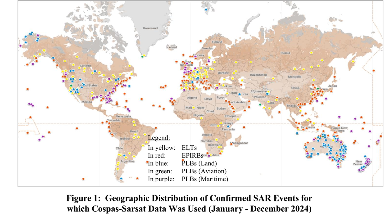
The geographic spread is the point: the system is used across oceans, coastlines, mountains, wilderness areas and aviation routes worldwide. It is not simply a marine rescue network.
Related guides: What is a Personal Locator Beacon? · What is an EPIRB?
A genuinely worldwide rescue system
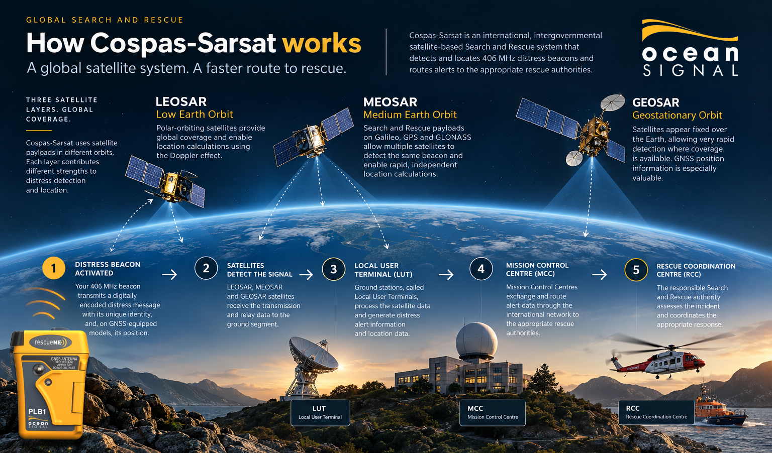
Cospas-Sarsat’s Global Search and Rescue Day describes the system as providing 100% coverage — every point on Earth’s surface. It is designed specifically to detect 406 MHz distress beacons and relay those alerts through an international government-backed Search and Rescue network.
Cospas-Sarsat: global coverage & MEOSAR quick statistics · Globalstar coverage maps & limitations
For Global Search and Rescue Day 2026, Cospas-Sarsat’s verified headline figures describe a worldwide network of 70+ satellites and 34 Mission Control Centres on watch 24/7, with a typical MEOSAR alert time of under five minutes.
For a more granular operational snapshot, System Data No. 51 lists, at 31 December 2025, 3 operational LEOSAR payloads, 11 GEOSAR payloads and 49 MEOSAR payloads — 63 operational SAR payloads in total. On the ground, it lists 49 LEOLUTs, 29 GEOLUTs and 26 MEOLUTs — 104 operating Local User Terminals in total — together with 31 Mission Control Centres in operation and 45 participating countries and organisations.
The two official publications present their figures on different bases: Global SAR Day uses rounded campaign-level verified figures, while System Data No. 51 provides a detailed status snapshot. This guide uses the Global SAR Day figures for headline communications and the System Data report for the detailed breakdown.
Global Search and Rescue Day verified figures · System Data No. 51, Summary Status →
Cospas-Sarsat combines Search and Rescue payloads on satellites in different types of orbit. Each layer contributes a different advantage to detection and location.
LEOSAR satellites operate in low, polar Earth orbit. Their motion relative to a beacon enables location calculations using the Doppler effect.
GEOSAR satellites appear fixed over the Earth, allowing rapid detection where coverage is available. Because they do not move relative to a beacon in the way a LEO satellite does, encoded GNSS position is especially valuable.
MEOSAR uses SAR payloads aboard navigation satellites including Galileo, GPS and GLONASS. Multiple satellites can detect the same beacon, supporting rapid alerting and independent location calculations.
Important distinction: MEOSAR can independently estimate a beacon’s location from its 406 MHz transmission. A modern beacon’s own GNSS receiver can additionally encode a more precise position into the distress message.
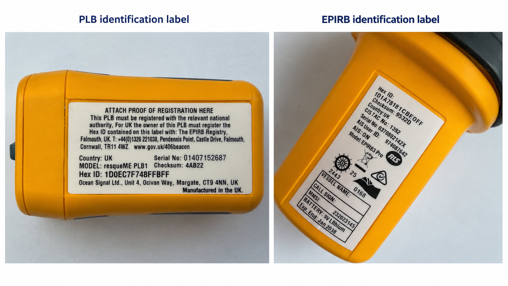
When activated, a compatible emergency beacon transmits a digitally encoded distress message within the internationally protected 406.0–406.1 MHz frequency band.
The unique identity is commonly called the Hex ID or UIN. First-generation 406 MHz beacons use a 15-character Hex ID; second-generation beacons use a 23-character identifier. This is the key identifier used to connect the transmitted beacon identity with the appropriate registration record.
The message can include:
Your Hex ID identifies the beacon. Registration helps rescuers understand who may be in trouble.
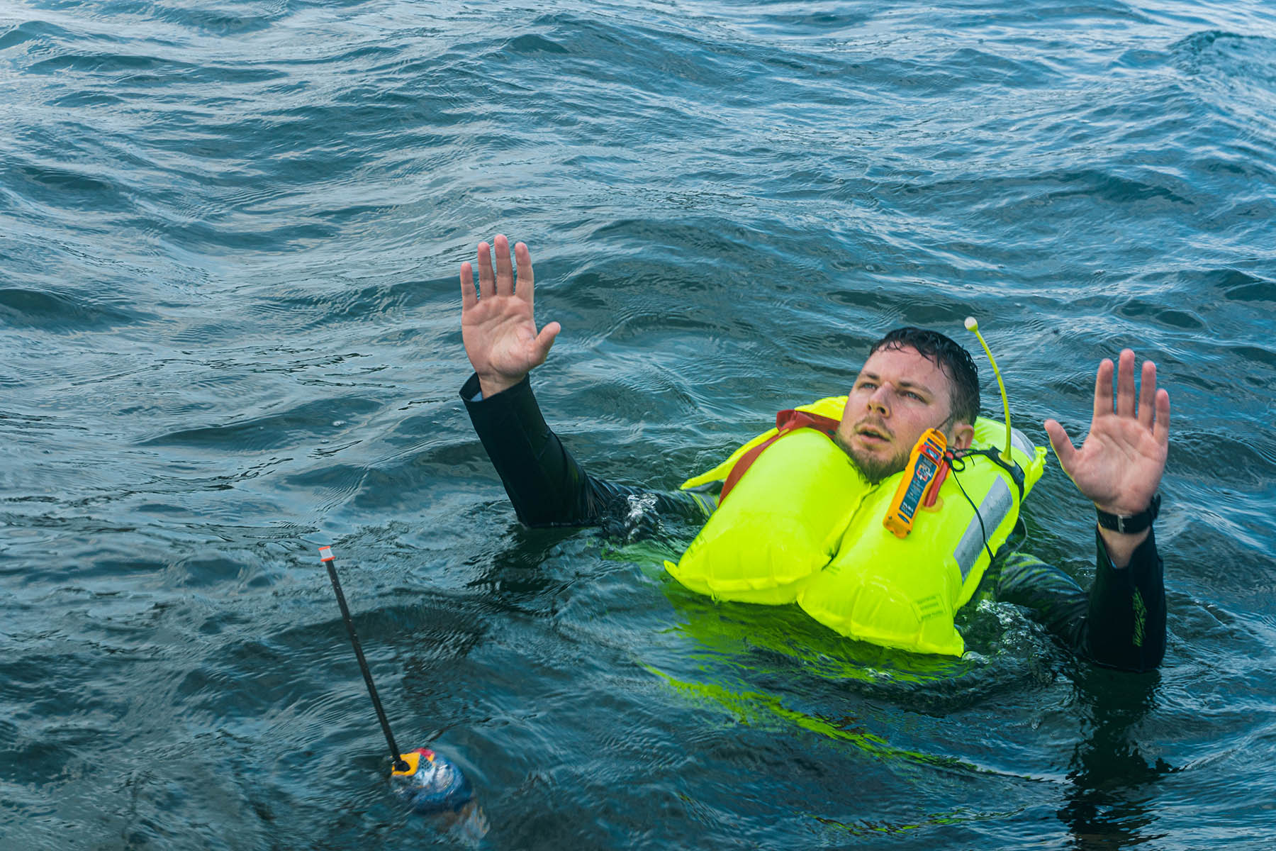
These technologies are often grouped together in beacon specifications, but each performs a different role.
| Technology | Primary role | What it contributes |
|---|---|---|
| 406 MHz | Global satellite distress alert | Carries distress data and the beacon identity through Cospas-Sarsat. |
| GNSS / GPS | Precise position | Coordinates can be encoded into the 406 MHz distress message. |
| 121.5 MHz | Local homing | Equipped SAR teams can use direction finding when closing in on the beacon. |
| AIS | Local maritime alerting | On AIS-equipped models, nearby compatible vessels can see the location of the person in distress. |
| RLS | Return acknowledgement | Confirms to an RLS-enabled beacon that its alert has been received and located by the system. |
121.5 MHz remains relevant. Satellite monitoring of old 121.5 MHz-only distress beacons ended in 2009, but 121.5 MHz continues to provide local homing capability on many modern 406 MHz beacons.
For a current example, the Ocean Signal rescueME PLB3 combines 406 MHz Cospas-Sarsat alerting, GNSS, 121.5 MHz homing, local AIS and Return Link Service in one personal beacon.
The rescue chain starts with one critical human action: recognising a serious emergency and activating the beacon. From there, the distress alert moves through the satellite and ground network before reaching the people who coordinate the physical rescue.
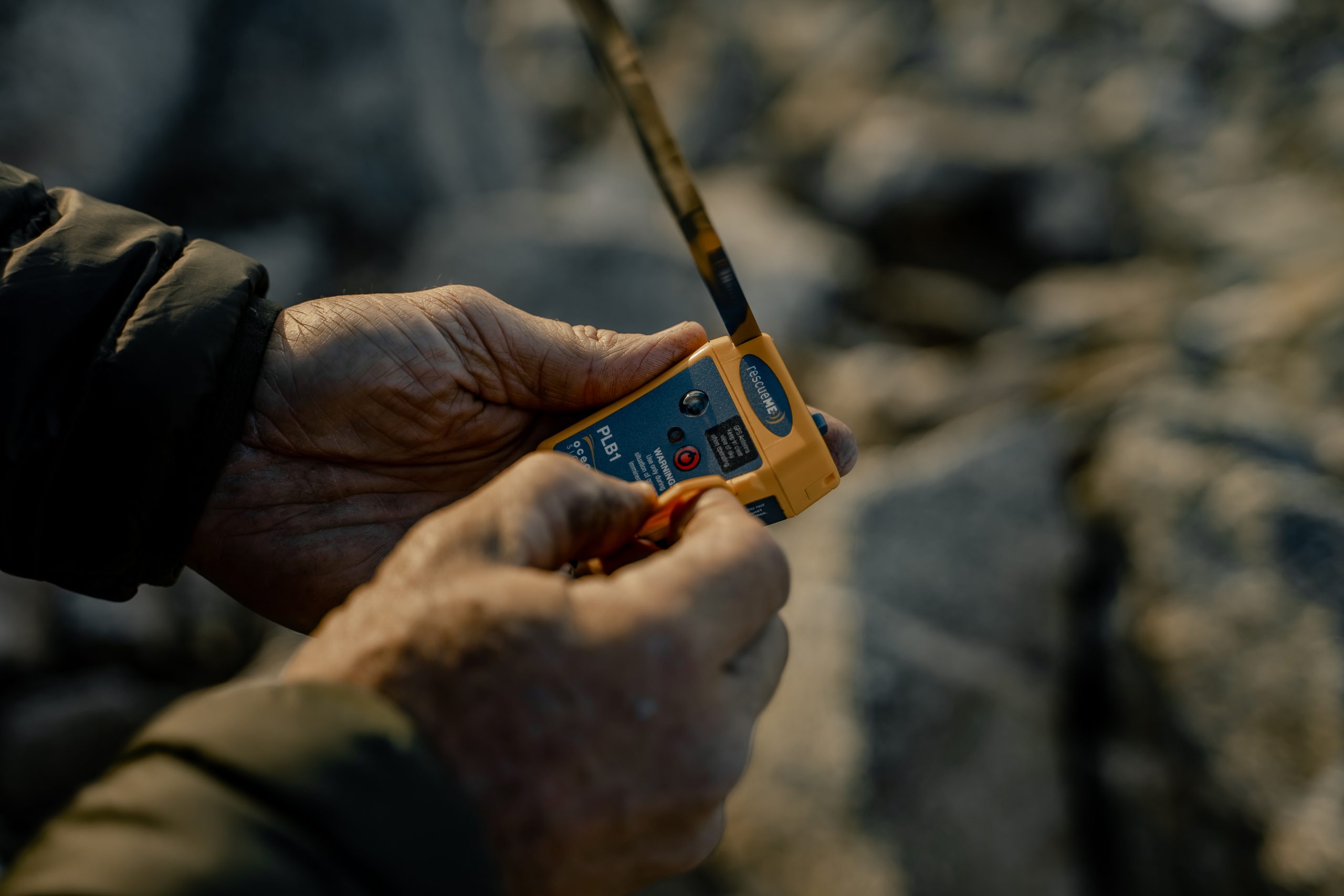
In a grave and imminent emergency, activating a PLB, EPIRB or ELT starts the distress-alert process. The beacon begins transmitting its unique 406 MHz digital identity and, on GNSS-equipped models with a valid fix, its position to the Cospas-Sarsat satellite system.
LEOSAR, GEOSAR and MEOSAR Search and Rescue payloads can detect the beacon transmission and relay distress data into the Cospas-Sarsat ground segment. Cospas-Sarsat states that compatible signals can be detected anywhere on Earth, with MEOSAR supporting alert times of under five minutes.
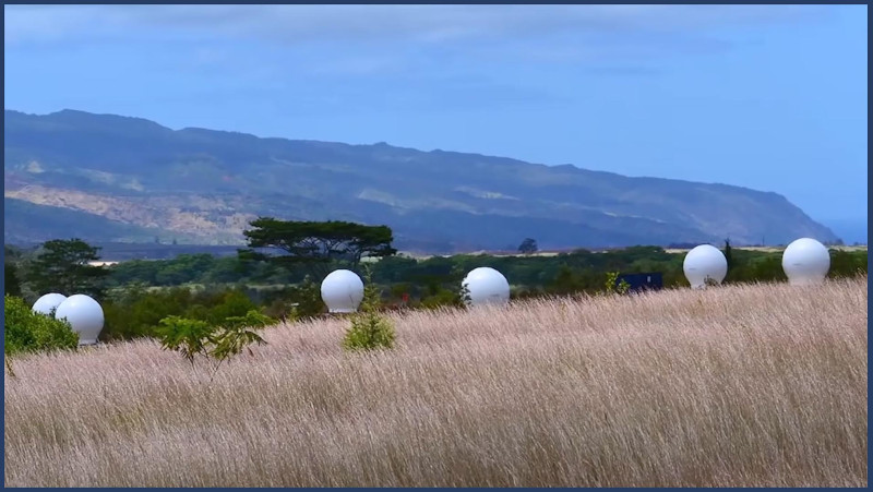
Ground stations called Local User Terminals (LUTs) receive satellite downlinks, process beacon data and generate distress-alert and location information. MEOLUTs receive Search and Rescue data from medium-Earth-orbit satellites.
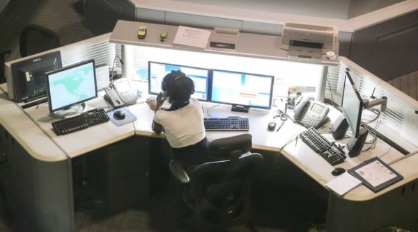
Mission Control Centres collect and route 406 MHz distress-alert information received from LUTs and other MCCs towards the appropriate Rescue Coordination Centres and Search and Rescue Points of Contact.
When a registered beacon is involved, its unique identity can be connected with information held in the appropriate registration system. This is where a technical Hex ID begins to become part of a real Search and Rescue case.
Once the responsible rescue authority has assessed the alert, the satellite and ground-system chain gives way to something much more human: the rescue services able to reach the person in distress.
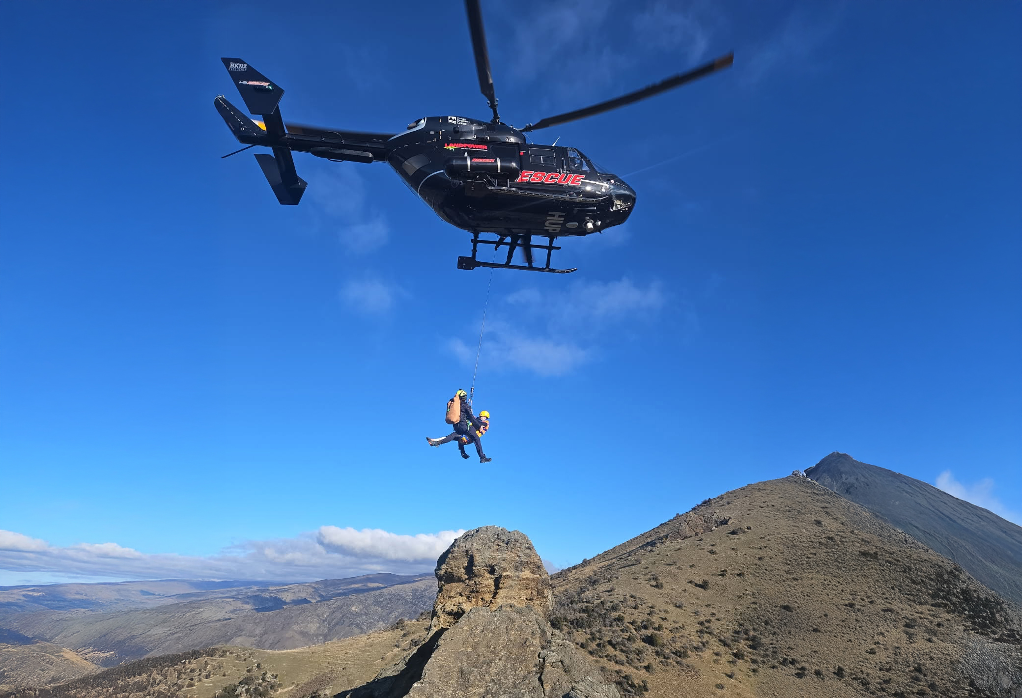
Exactly who responds depends on where the emergency happens and what resources are available. Around the world, that can mean national coastguards, military Search and Rescue crews, volunteer lifeboat organisations, alpine rescue services, specialist medical teams, local emergency services and sometimes nearby vessels already close to the scene.


One global distress system can feed many very different local rescue responses.
Cospas-Sarsat does not operate the helicopter, lifeboat or ambulance. Its role is to help get a 406 MHz distress alert and location information into the international Search and Rescue chain, where the appropriate national or local authority can coordinate the response.
Registration does not make the satellite detect your beacon faster. A compatible unregistered beacon can still transmit a 406 MHz distress alert.
Registration changes the information available to Search and Rescue once the alert has been received. Depending on the country and beacon type, a registration record can include owner details, emergency contacts, vessel or aircraft information and other details that help rescuers understand the incident.
At the end of 2024, national administrations reported about 2.5 million registered 406 MHz beacons worldwide. Cospas-Sarsat estimated the potentially activatable global beacon population at about 3.4 million using its registration-rate method. Registration is what helps connect one unique beacon identity among millions with useful information about the person, vessel or aircraft behind it.
Source: Cospas-Sarsat System Data No. 51, Beacon Population →
Registration does not speed up the satellite. It can make the alert far more informative when it reaches the people coordinating the response.
PLB registration and EPIRB registration are handled nationally. Register according to the country coding programmed into the beacon, not simply the country where you happen to be travelling. These are the same main country resources covered in the Ocean Signal PLB Guide, updated where a national registry has changed.
United Kingdom
UK 406 MHz Beacon Registry →
United States
NOAA Beacon Registration →
Canada
Canadian Beacon Registry →
Australia
AMSA Beacon Registration →
New Zealand
RCCNZ Beacon Registration →
France
French 406 MHz Beacon Registry (CNES) →
Spain
Salvamento Marítimo / SASEMAR →
Netherlands
Netherlands Coastguard →
Sweden
Swedish Maritime Administration →
Norway
Norwegian Beacon Registry →
Denmark
Danish Maritime Authority →
Finland
Traficom →
Japan
Japan Coast Guard →
Country not listed?
Cospas-Sarsat official Beacon Registration Contacts →
Important: several countries use different authorities or procedures according to beacon type and coding. For any country where the national link above is an information starting point rather than a direct registry, confirm the correct PLB, EPIRB or ELT registration route using the official Cospas-Sarsat Beacon Registration Contacts directory.
Beacon programming sets the approved transmission coding inside the beacon, including its relevant country identity and protocol.
Official 406 MHz beacon registration connects the beacon identity with information available to Search and Rescue authorities.
Ocean Signal product or warranty registration relates to product ownership and applicable warranty benefits. It does not replace official SAR registration.
New UK PLB registration requirements came into force on 15 April 2026.
PLBs carried aboard UK-flagged vessels, hovercraft and mechanically propelled watercraft such as jet skis are now required to be registered with the UK 406 MHz Beacon Registry.
The specific legal requirement does not extend under these provisions to PLBs carried on unpowered craft such as kayaks, canoes and paddleboards, although the Maritime and Coastguard Agency encourages wider registration.
The MCA reported that 92% of UK 406 MHz distress alerts received in 2024 were false alerts. Accurate registration provides another useful source of information when an activation is investigated.
MCA MGN 665 (M+F) Amendment 1 — registration requirements and 2024 false-alert data →
A Hex ID does not automatically know that a beacon has changed hands. If you buy a used beacon, make sure its official registration is transferred or re-registered correctly. If you sell or gift a beacon, notify the relevant registry so your details are no longer associated with it.
When a beacon is retired or destroyed, cancel or update its registration and dispose of the beacon and battery in accordance with the manufacturer’s guidance and local rules.
From the Ocean Signal survivor stories
The system can sound abstract until you see the people at the other end of it.
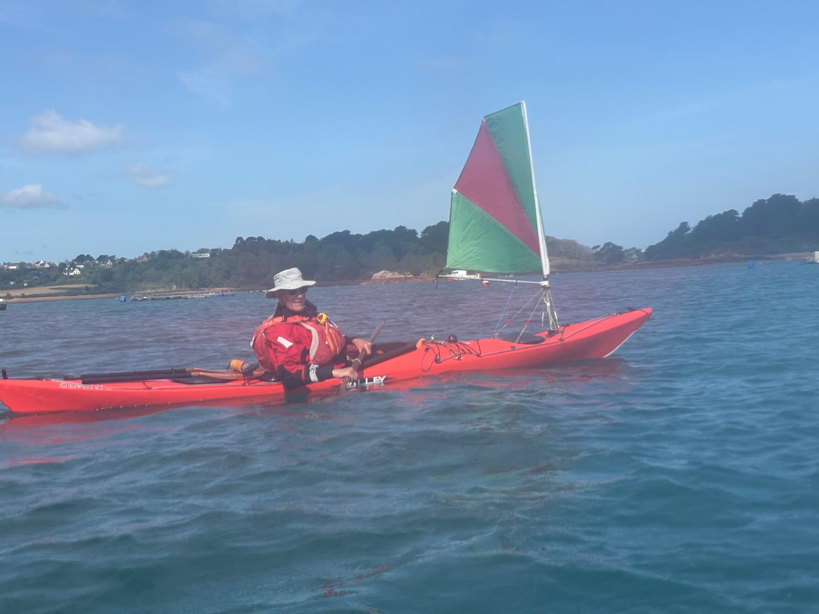

Ocean Signal survivor stories repeatedly show the same basic chain in different environments: a person or crew activates a 406 MHz beacon, the alert reaches the international system, a rescue authority takes over, and local SAR assets do the physical work of reaching the casualty.

SARSAT stands for Search and Rescue Satellite-Aided Tracking. COSPAS comes from the Russian name for the satellite search-and-rescue system developed by the former Soviet Union. The two programmes were combined into the international Cospas-Sarsat system.
A compatible 406 MHz PLB, EPIRB or ELT is activated; satellites detect the distress transmission; Local User Terminals process the satellite data; Mission Control Centres route the alert; and the responsible Search and Rescue authority coordinates the local response.
The official 2026 Global Search and Rescue Day verified figures state that Cospas-Sarsat uses 70+ satellites across LEO, MEO and GEO orbits. For a detailed operational snapshot, System Data No. 51 listed 63 operational Search and Rescue payloads at 31 December 2025: 3 LEOSAR, 11 GEOSAR and 49 MEOSAR.
No monthly satellite subscription is required for a certified 406 MHz PLB or EPIRB to send its distress alert through Cospas-Sarsat. The beacon should still be correctly programmed, officially registered and maintained according to the manufacturer’s instructions.
Yes. Cospas-Sarsat’s Global Search and Rescue Day describes the system as providing 100% coverage of the Earth’s surface. The system is designed to detect compatible 406 MHz distress beacons worldwide, although the speed and conduct of the physical rescue response still depend on local SAR resources, geography, weather and the incident.
No. Cospas-Sarsat is an international government-backed Search and Rescue system dedicated to compatible 406 MHz distress beacons. Globalstar is a commercial satellite communications network. Globalstar services can be valuable, but their coverage and availability depend on the specific product, geography and regulatory approvals.
The principal categories are Personal Locator Beacons (PLBs), Emergency Position Indicating Radio Beacons (EPIRBs) and aircraft Emergency Locator Transmitters (ELTs).
No. A compatible 406 MHz beacon communicates through Cospas-Sarsat rather than relying on a mobile network or Wi-Fi connection.
No. Registration improves the information available to Search and Rescue after an alert is received; it does not alter satellite detection speed.
A compatible beacon can still transmit a distress alert without a registration record, but authorities may have less owner, contact or vessel/aircraft information available. Registration may also be legally required in your jurisdiction.
RLS allows a compatible beacon to receive an acknowledgement through Galileo after its distress alert has been received and located by the Cospas-Sarsat system. It does not confirm that a particular rescue asset has already launched.
No. AIS is a separate local maritime radio system. On an AIS-equipped PLB or EPIRB it can complement the global 406 MHz alert by broadcasting the distress position to nearby compatible AIS-equipped vessels.
No. Ocean Signal product registration relates to product ownership and applicable warranty benefits. Official 406 MHz beacon registration connects the beacon identity with information available to Search and Rescue authorities.
A 406 MHz beacon is designed for the day you hope never comes.
Check your registration. Confirm your emergency contacts. Know how your beacon operates. Check its service and battery status. And carry it somewhere you can actually reach it when you need it.
A few minutes spent preparing today can make the information available during a future emergency far more useful.
Continue learning: What is a Personal Locator Beacon? · What is an EPIRB? · PLB1 vs iPhone Emergency SOS · Explore rescueME PLB3
Key factual and regulatory claims in this guide were checked against primary authorities:
Last technical review: . Regulations, beacon coding and registration processes vary by jurisdiction and may change. Always follow the latest instructions supplied with your beacon and the relevant national authority.
Estimated reading time: 23 minutes